Sydney to the Pacific North-West
New Zealand
 After nearly a decade of planning and preparation, we finally cut our ties in Sydney and sailed for New Zealand in late 1981, starting a voyage in our yacht “Cera” which was to end eight years later, to the very month.
In 1974, after years considering the possibility of ocean voyaging, we committed to contracting the building of a strong fibreglass hull and deck, and then fitting it out ourselves. This would include all the interior woodwork and fittings, engine installation, assembling all spars from contracted parts, and making all nine sails. In 1977 we made a 2000+ nautical mile return trip to New Caledonia by way of a maiden voyage. This made practical the dream that we could and would make a complete getaway, living aboard under sail for an extended but indeterminate period of time.
The planned first stage of the voyaging was to sail generally north-east across about 10,000 nautical miles of the Pacific Ocean, hoping to make Vancouver. I had spent a weekend sailing with a doctor friend up there, and ever since then, dreamed of taking Cera to these waters. Our daughter Anita preferred to continue with her work in Sydney, so there were only the two of us aboard as we sailed through Sydney Heads on 28 September 1981, on the heels of a sou-westerly gale. The following strong northerlies gave us a superbly fast although very rough ride across the Tasman.
We had lots of practice in celestial navigation on this passage, with sun sights (when possible) at least once a day, and shots of Venus and assorted stars dawn and dusk when available. The heavy northerly swell made sighting difficult as well, but there was enormous satisfaction in plotting a position in which we could feel confident. However, the nearer we got to New Zealand, where sailing always presents its challenges, the cloudier the skies became and the harder it was to get a good fix. To help in dead reckoning we towed a Walker log.
We realised following a sextant sight of a hazy sun that the steady, heavy northerly winds of the previous few days had set us to the south of our planned course. We had not seen the sun for days and had been relying on snap star shots in difficult conditions. So, we had to harden up against the increasing strength of the north wind to make sure we well cleared the northern headlands, because there are wide expanses of dangerous shoaling water and breaking waves well off the coast in that area.
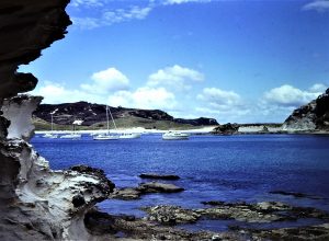
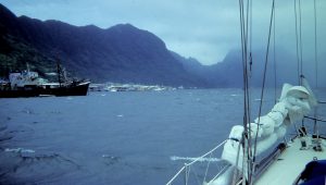
We first glimpsed Cape Reinga at the north-west tip of the North Island through mist on the afternoon of 5 October, a week after leaving Sydney - a good time, but very hard work. We continued east across the impressive North Cape with the wind building to a full gale, with the boat still sailing (too) fast under only the mainsail with two reefs. Heavy rain didn't help things, either.
Turning south-east after clearing North Cape was a bit of a relief, but the wind was relentless and we were by then sailing too fast - certainly too fast for the self-steering system, so that we had to fight the wheel ourselves. Soon after midnight and tired, in these conditions, of course, things tend to go wrong. We had trouble reefing the mainsail to its minimum size, because the wind was pinning it to the mast and I couldn't pull it down. While trying to sort that out, the wind suddenly shifted from north to west-sou-west. This caused a violent gybe from port to starboard tack, throwing me across the boat and carrying away part of the anti-gybe system at the boom.
We were still sailing too fast for our planned time of arrival (in daylight) at the Bay of Islands, so chose to heave to in the still gale-force WSW wind off the Cavalli islands. We got going again at five in the morning, the wind was dying, and we finally entered the Bay of Islands for a calm motorsail down to the wharf at the official Port of Entry, Opua. We had sailed 1161 nautical miles in seven days, 19 hours and 30 minutes, with an average speed for the whole distance of over 6 knots. We resolved not to try to better that!
We found later, after our arrival, that the solid stainless steel shaft for the self-steering vane rudder was bent during this episode, and the transom mounting for the vane was also disrupted. This had allowed seawater into our aft sleeping cabin, which soaked the blankets. All part of the learning experience!
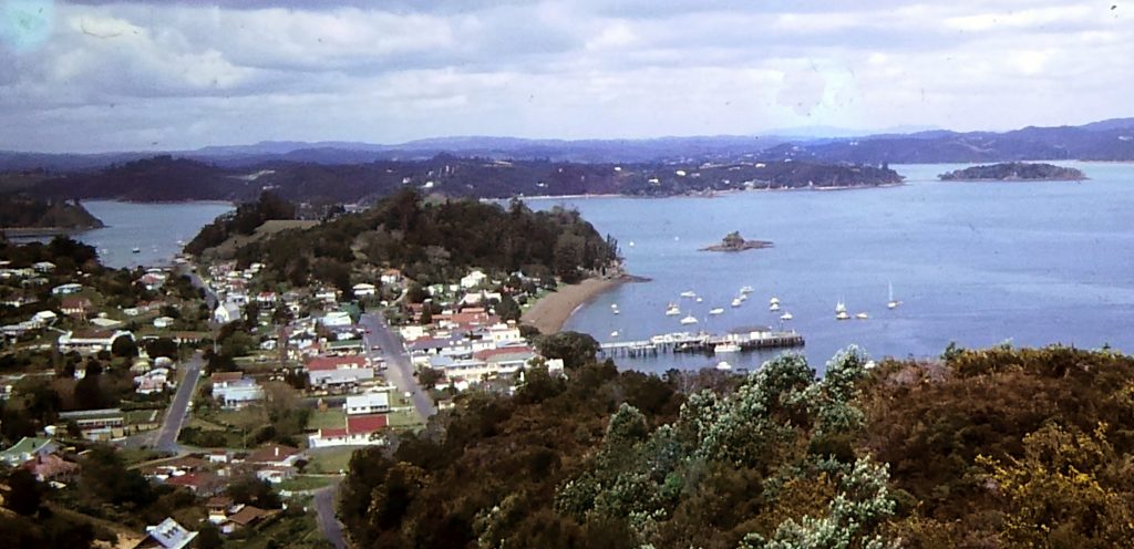
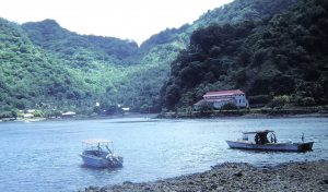
Russell, Bay of Islands
We subsequently found this wet and windy final approach to New Zealand to be typical of other voyagers’ experience! In fact, the weather is always a great topic of conversation in New Zealand. There are incessant forecasts on the local radio, and very detailed coastal forecasts several times a day try to make sense of the country’s constantly changing mixture of rain and sun, wind direction and speed. In retrospect, we realised that the weather did shape our cruise in Kiwi waters.
Our introduction to local conditions was the six weeks we spent in the Bay of Islands, where our itinerary was governed by wind direction and strength rather than the cruising guide (the excellent book published by the Royal Akarana Yacht Club).
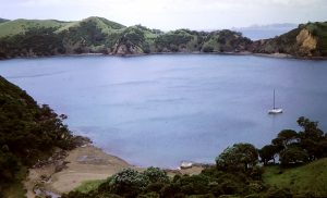
Roberton Island
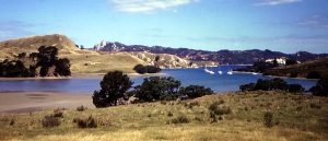
As we moved around, seeking shelter from the predominant sou-westerlies, we poked into virtually all of the scores of bays in the Bay of Islands area, mainland anchorages being more numerous and generally better sheltered than at other islands themselves. We generally used the little town of Russell as a base for provisioning, and because a Kiwi friend allowed us to use his mooring in popular Matauwhi Bay, a short walk to the south.
But the beauty of the Bay of Islands certainly does lie in the islands, where we stayed whenever conditions allowed. Perhaps the loveliest island is Roberton Island, also known as Motuarohia Island, as it was called before being purchased from Maori chiefs in 1839 by a whaling ship captain named John Roberton. Moturua Island even offered another benefit: water was piped over to a number of buoys, so that visiting craft could easily fill up with clean, fresh water. We had never come across such a feature before. 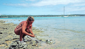
Water buoy
Norma soon got into fishing mode, getting very successful in line fishing off the boat and ranging the shorelines for shellfish, including razor clams (delicious) and small "pippies".
To seek the ultimate shelter we motored four miles up the Kerikeri River to the basin a couple of miles from the town, a trip not often undertaken by cruising yachts because of worries (reinforced by dire warnings from “local knowledge”)  about depths in the channel. The river basin at Kerikeri had been swept by devastating floods in March 1981, and the pundits claimed that subsequent silting would make the trip a dodgy one. In practice, we found it an easy and well-marked channel at high tide. We spent three happy weeks in the basin, enjoying the friendliness of the local people (one of whom let us tie up to his pile-moored yacht, very close to the wharf) and the quiet beauty of the historically-interesting area.
Well sheltered from the winds, our only worry followed a night of heavy rain, when edgy local yachties came down to tie their boats and ours to every conceivable tree, pile and bollard. The floods earlier that year had swept away all the piles, and boats big and small were washed around the basin and down the river like so much flotsam.
 On the way out of the Kerikeri River we took advantage of another helpful feature of cruising in New Zealand. Because of the wide tidal range, it is possible to tie up to public "grids", as they call them here, where the boat can be tied up and the bottom cleaned at low tide. Free and quite easy.
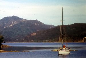
In improving weather we then took a pleasant sail offshore, back up the rocky coast north to the spectacular volcanic inlet of Whangaroa Harbour. We settled in the sheltered anchorage of Rere Bay under the Okomoto hillside. We climbed the hill for the amazing view down to the bay and the boat.
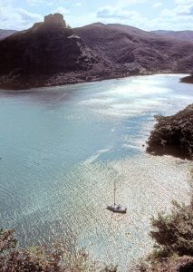
Rere Bay from the top of the hill
Rere Bay, Whangaroa Harbour
We were friends with the crews on many other cruising yachts by this time, so when moving round the various anchorages we rarely went an evening without hours of happy talking.
We had another very pleasant sail back down to the Bay of Islands, interrupted briefly by a Customs boat whose officers politely asked us where we were from and where we were going. We also caught some excellent fish, trolling a line. After a wet night in Matauwhi Bay we did some provisioning in Russell, then moved around a few more islands and bays - such Otehei Bay, made famous by Zane Grey, deep and rather rolly.
Whangamumu Harbour
As the spring seemed to have arrived by this time (early December – a “late season”, apologised the locals) time was up for the Bay of Islands, and we sailed out and down the rocky and attractive coast towards Auckland. The first stop was at Whangamumu, a splendidly pretty and near-circular anchorage with an old whaling station ashore.
On our way daily, we continued calling into several of the beautiful and sheltered harbours on the north-east coast. We had the calmest weather of the summer at this time, allowing some delightful ghosting sails in smooth water as we headed south.By this time we were quite convinced that earlier plans to sail to the Marlborough Sounds in South Island could be scrapped. Every local sailor we spoke to had had a bashing on each of the Cook Strait capes on the east coast (some suggested going all the way round the top and coming back down the west coast), and whenever there was not a gale warning for Cook Strait there seemed to be a storm warning. We therefore resolved to stay in the (hopefully) sunny north.
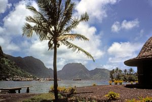
Mansion House Bay
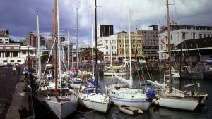
A memorable stop was at Kawau Island, in Mansion House Bay. This is a very popular anchorage. The Mansion House is a beautiful old residence, and there is a nice walk to a deserted copper mine. After a few days we had a pleasant sail down towards Auckland Harbour and spent a night anchored by the volcanic peak island of Rangitoto. The next day we sailed up past the city centre to the huge Westhaven marina. We got out the folding bikes and had a great time touring the city centre and visiting the excellent museum. Two days before Christmas, we also did some Christmas shopping and had a rare dinner out to celebrate our wedding anniversary.
Auckland was very crowded with local and visiting yachts, so we sailed out of Hauraki Gulf, spent a night in Waiheke Island then on a bit further to Tryphena Bay, Great Barrier Island. We were planning to return to Great Barrier, so pressed on after a short stop south to the Mercury Islands, a magnificent holiday playground for boating people, with a sheltered all-weather anchorage, plenty of other beaches, delightful walks, good fishing and diving.
Coralie Bay, Gt Mercury Island
Here, we were able to observe some features of yachting, New Zealand style. First, they are really keen boat users. The small anchorage was crammed solid every night, but right after breakfast the air was alive with the sound of anchor chains as everyone set off on the day’s activity. By mid-day the place was practically deserted. As sun fell, back they all came, anchoring (necessarily, but generally more skillfully than we had been led to believe) in extremely close proximity one to the other. Those for whom washing in a nearby stream or waterfall had been the activity of the day returned with boats festooned with drying clothes flying from lines strung in the rigging. Kiwis don’t mind handling their ground tackle; for example, to run the engine they prefer to go for a potter round, rather than sit in an otherwise quiet anchorage with the motor running in order to get the batteries up and the fridge down.
Mercury Cove
Activities such as swimming in what we thought was pretty frigid water, and particularly fishing, seem more popular among sailors in New Zealand than Australia. Mind you, as summer arrived properly we continued to find the fishing very good; we generally caught kingfish or a local small game fish, the kahawai, while trolling. Off the anchored boat Norma was often spectacularly successful catching old-man snapper such as seem to have disappeared from NSW coastal waters. When the fish run out, there are plenty of shellfish for the taking from the beaches. However, oysters are protected, for reasons we could never fully ascertain; there are millions of them.
Further down the east coast of the South Island we sailed as far south as Tauranga, on the Bay of Plenty. This is a major commercial port, short on anchorages but with a yacht club with showers and washing machine, and good provisioning in the town. Then, via some island anchorages including returns to Mayor Island and Mercury Island, back to Auckland. This meant a sail close round the rightfully notorious Cape Colville, where wind against tide produces foul, wet, steep, yacht-stopping overfalls, and where the towering Coromandel ranges collect tons of cold air to hurl in large bundles at yachts foolish enough to tackle this maelstrom. We took a rest at Waiheke again before pressing on back to the city, about a month after we had left it.
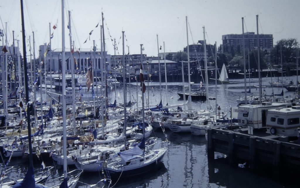
Marsden Wharf; Cera front row, second out
Auckland was fun enough to keep us there for six weeks, berthed in a raft-up of other overseas cruising yachts at Marsden Wharf, in the commercial centre of the city. Some days were spent battling a very painful attack of renal colic; finally passed the stone with great relief. Marsden wharf was very sociable and good fun, but very busy; finally, dirty feet tromping across our decks, plus the amount of money being drained from our cruising funds, drove us away back to the islands of the Hauraki Gulf, Auckland’s home cruising grounds. Just outside Auckland Harbour lies the scenic reserve island of Rangitoto, and it was good to drop anchor and swing on it in a sheltered, quiet bay. It was March by this time, and the local yachties were back at work, leaving the anchorages to the long-term cruising community.
We then returned to our favourite, Kawau Island. Along with its social attractions and good company every day, there is a little yacht club complete with shop, showers and washing machine. By this time we were used to the weather, so we were happy to wait for favourable conditions before going anywhere. But we badly mistimed our sail from Kawau to Great Barrier Island, being hit ten miles out by a vicious sou-easter and the short seas which rapidly build up in the Gulf. So we turned back and spent another week in Kawau.
 We had long decided to spend time in Great Barrier Island, and it was an obvious next stop on the way back up to the Bay of Islands. Great Barrier Island is as great a cruising ground as we expected, in our eyes strongly reminiscent of Broken Bay, but with a backdrop of mountains. We spent three weeks there, exploring many of the numerous anchorages, and sharing good times with the numerous friends we had made in New Zealand. We climbed the highest peak, Mount Hobson. New Zealand is a great place for walking, and as we puffed our way round the myriad trails in the North Island we could at least console ourselves that we were not decaying from under-activity. Norma kept us, and often other boats too, with excellent fish. We got it some much-needed boat maintenance, too, because the next ocean passage was likely to be a tough one.
Just before Easter we picked up news on the radio of an early-season cyclone floating about well to the north, although expected to pass clear of New Zealand. But although the anchorages in Great Barrier are supposed to give good cyclone protection, we decided to move out, as time was moving on anyway.
And so back to the Bay of Islands, in a fast and enchanting moonlit sail to our friend's mooring in Matauwhi Bay, Russell. The very next day the wind whistled in the rigging as a 988mb depression passed through (the remains of tropical cyclone Bertie). We later heard that there was havoc in the Barrier anchorages, with many boats dragging anchor and some suffering damage. Gusty winds of up to 70 knots were reported. We were very pleased to have pulled out in time.
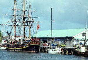
Whangarei wharf, waiting for Customs clearance behind the Bounty replica
We were able to use our friend's "grid" in Matauwhi Bay for drying out and antifouling. We got on with provisioning for the next leg, and minor work on the boat. This last included extensions to our already cosy cockpit dodger, making it even more of an acrylic pilot house; we had noticed that the longer boats have been cruising, the better the shelter they provide for their watch-keepers!
After three weeks the nights were getting cool, and we reluctantly realised our New Zealand summer was nearly over – a summer which everyone there told us was exceptionally good, “one for the books” as a passing sailor called.
Taking three overnight stops on the way south, and assisted by an old Australian sailing friend, we sailed down to Whangarei, a Customs port from which we would depart for Fiji. We cleared for departure after more stocking up the duty free and other provisions, and sailed away in apparently clearing weather on the afternoon of May 3, 1982.
Fiji
Fiji landfall, 0600 12 May 1982
A warm wind came in from the south, the flying fish played chasing games with fast predators, the blue of the sky was interrupted only by the white puffy cumulus, and we knew that, for the first time since our New Caledonia trip five years before, we were truly in the tropics. In a few days we would be closing the barrier reef off south-west Fiji.
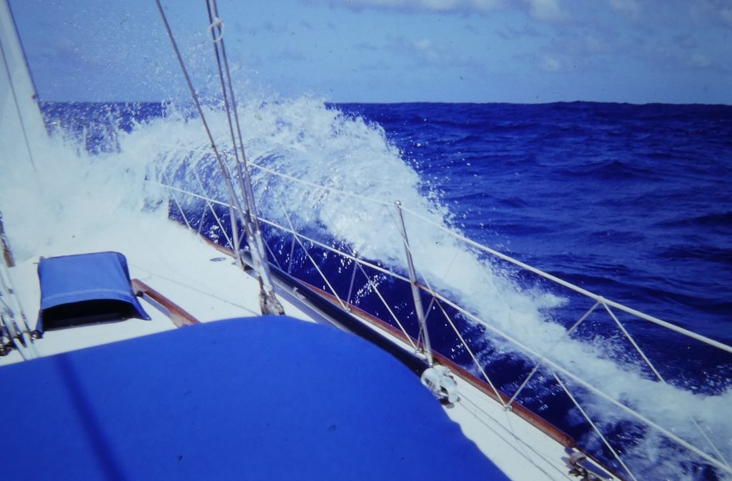
The pleasant conditions were a welcome relief from the very heavy weather into which we had bashed and slammed close-hauled for the first few hundred miles north from New Zealand. There were no mishaps on the way, but we heard later that other boats had suffered some damage in the same squally conditions. As the passage came to an end, we carefully navigated the reefs guarding the western approaches to Viti Levu, and then drifted gently up Nandi Waters to Lautoka.
We anchored between two boats we knew well, in black mud after a total of eight and a half days, a running average for the trip of 125 miles a day. One of the neighbouring boats was Wanderer V, the latest yacht to be owned by the famous British multi-circumnavigators and authors Eric and Susan Hiscock. One of their early books, Voyaging Under Sail, was probably the single most significant inspiration for our own commitment to long-distance cruising. They were delighted when we told them that, and we became good friends. Their way of going about this kind of life was completely in accord with ours: sailing the oceans of the world with a minimum of fuss.
Then in Lautoka, of course, we had to navigate the absurdities of "clearing in": first, a visit by the quarantine man for pratique, then to the immigration and agriculture offices ashore, the Customs on board. He solemnly pasted a sticky label over our drinks locker to ensure we couldn't touch our bonded alcohol supplies.
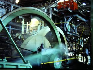
Sugar mill machinery
Lautoka is the main sugar port in Fiji, lying on the west side of the big island of Viti Levu. When the crushing season started soon after our arrival the customary pall of black smoke hung over the anchorage, with appalling fallout. The sugar mill, which we visited, is archaic, even surreal in a pre-industrial revolution way. Immense steam engines were turning six-metre flywheels propelled by boilers fuelled with the fibres from the sugar cane, belching black smoke. Most days we had to scrub the sticky black fallout from the deck.
But it's a very pleasant little city, and we enjoyed our first walk through the shopping areas. Lots of touristy shops, of course, but the goods were of good quality. The markets were excellent, too, and Norma commented that "I'm going to enjoy shopping here". After a few days settling in, writing letters, getting local money and reprovisioning, we took the local bus to Nandi airport to pick up Anita, who was going to join us for a while on the boat exploring the nearby small islands in the huge western Fijian lagoon.
Before that, though, we had to go back to Customs for clearance to do so, resulting in a little drama. We had taken the sticky label off the locker to raid the bonded liquor supplies. The Customs man, in his office ashore, said that he wanted to come out to the boat for an inspection. I panicked, and confessed - but he didn't seem to react adversely. Norma saw me coming back with the officer in the dinghy, and as he climbed aboard she whispered to me "I've put it back!" Fortunately, and in Fijian style, nothing more was said by any party.
Beachcomber Island, where Anita had fun with US and Canadian visitors (Google pic)
With Anita aboard, we first explored several of the “resort” islands that we would probably have skipped past if we had been on our own. Generally, these resorts welcome yachties, or at worst ignore them. We and Anita all had fun, as she made friends with holiday-makers and at Beachcomber Island invited them aboard so that they could dive off the rigging. The best resort appeared to be Mana Island, with a pleasant lagoon entered through a very narrow, winding pass through a steep coral reef.
Mana islanders
We found the facilities at Mana to be good, the staff friendly, and the skin diving off the fringing reef – which has a vertical drop-off visible for over a hundred feet down – exceptional. The lagoon, however, is wide open to the south, and more sheltered anchorage was to be found – the best in the entire western waters, for that matter – off another, smaller resort, Dick’s Place on nearby Malolo-lailai Island. There are a couple of small shops here, and the good shelter from practically all winds makes it very popular with cruising yachts. The bay, entered through a tortuous mass of coral, is called “Musket Cove”. For a dollar a head we became life members of the Musket Cove Yacht Club, with all the facilities of Dick’s Place at our disposal.
 Eric and Susan Hiscock, in their new Wanderer V, were among the many cruising people spending several weeks in this lovely spot. This charming and unassuming couple were having some trouble with their new yacht, including breaking their self-steering early on their planned voyage to Tahiti. Diverting to Fiji and suffering the same bad conditions as we had, they hand steered watch on and watch off for a week at sea, a prospect which brings shivers to any cruising spine! We had the pleasure of doing some work on their sails and boom during the weeks we were anchored close by them.
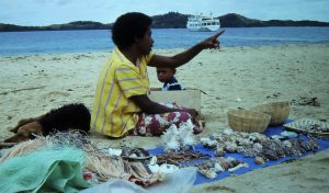
Anita having flown back to Sydney, we checked back at Lautoka for the relevant permissions, and sailed for the Yasawa Islands. The group is a string of small islands ranging from 20 to 30 nautical miles (40-50 kilometres) off north-western Viti Levu, the main island of Fiji. Yachts have to check in and out of Customs at each major port and, in addition, to visit the outer islands permission is needed of the relevant District Commissioner, or, in the case of the Lau Group, the Prime Minister himself (these islands are his electorate).
Coral reefs in the Yasawas
The Yasawas are popular cruising country, but with several traps for the unwary. The only detailed “charts” are a set of plans drawn up by a New Zealand surveyor, Pickmere, and these made life a lot easier. The locally-produced chart, “Lautoka to the Yasawas”, is nowhere near detailed enough to plan anchorages or routes through the dense coral which extends for miles around. [Note: this was written as a contemporary account in 1982, and things have changed since then.] The chain of islands, an attractive green line of volcanic hills, lies roughly southwest to northeast; this means that moving north through the group, we were practically always sailing into the sun, which always makes piloting in coral difficult because the sunlight is reflected off the water and you can’t see through it. However, if we had stuck precisely to the book of words in the Yasawas, we would hardly have been able to move at all! So, we took extra special care and used a high conning position to keep us off the coral, which looks like flowers but feels like granite. The view from up in the spreaders is often absolutely gorgeous, with more shades of blue in the sea than you would ever see in a rainbow. (I shinned up the mast with the aid of a home-made rope ladder, analogous to the ratlines of square-rigger time.)
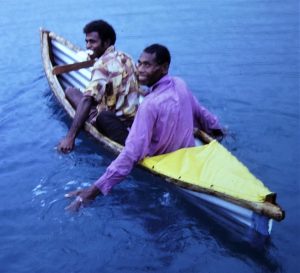
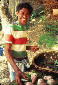
Api and Joe
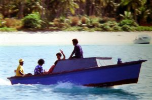
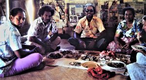
Anchorages in the Yasawas are, with one exception, pretty exposed, and in the windy weather which we had, we spent a lot of time chasing shelter. In calm, settled conditions the number of possible anchorages multiplies many times. An early stop was in the bay off Soso village, on Naviti Island, where we were visited by Api and Joe. They paddled out to us in a canoe made by folding up a sheet of corrugated iron! At Api's invitation we went ashore in the evening for our introduction to kava in his father's house, along with a selection of male villagers.
In the Yasawas we did eventually become used to the Fiji villagers’ way of life, which includes being welcoming to yachts – especially solitary yachts – to an extent which can sometimes be troubling. It is not in the least unusual to see a beaming black face pressed closely to the yacht's cabin window. Traditional customs here have to be followed. To anchor in any bay where there is a village, and certainly if we wanted to go ashore, permission has to be obtained from the chief of the village, and “sevu-sevu”, a ceremonial offering, presented. This is normally a bundle of yanqona root, a member of the pepper family, Piper methysticum, from which they make the drink kava. In the evening it is normal to be invited ashore to drink kava, and occasionally to share a meal.
In this case, of course, we already had the invitation, and were welcomed with much ceremony. Kava itself looks and tastes like muddy water – it is a mild narcotic, and leaves a numb sensation on lips and tongue. It has no intoxicating effect that we or other westerners can discern, but the locals call the stuff “grog” and seem to psych themselves into being mildly intoxicated – sleepy, anyway. There is much ceremony about how it is prepared, shared around and drunk, along with solemn celebratory claps. Taking alcohol into the villages is very much frowned upon, and there is no question that they are a lot better off on kava! Sadly some of the villagers do see yachts as providers of free stuff, and we and others were asked to give them various products from paint to (in our case) pills! We kept some paper pads and felt pans for the kids, which seemed to go down quite well, as frankly we weren’t carrying enough supplies to dole them out to the natives, even if we could afford to.
The Blue Lagoon
 The best protected bay, and one of the most beautiful, is off the west side of Nanuya-lailai Island. The anchorage is encircled by other small islands and is usually called the “Blue Lagoon”, because two famous films of that name have been made there. The catch is that every afternoon a cruise boat lies right next to the best yacht anchorage, disgorging its passengers for a night of entertainment aboard and ashore. We soon got used to this, and the crews are usually happy to welcome yachties ashore to join in the fun and to share drinks with the tourists.
We got very friendly with the local couple, Millie and Ben, who act as caretakers and make  preparations for the visiting cruise boats, including a coral and shell market. We enjoyed simple meals with them at their house near the beach.
We spent quite a while in this lovely anchorage, doing normal things like washing the sheets in the dinghy after an overnight rain storm!
[PS: There are now two resorts on this once near deserted beach.]
Leaving with some reluctance we sailed up to the small island of Sawa-I-Lau, among bigger islands near the northern end 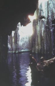 of the Yasawa chain. This is probably the most dramatic anchorage in the group. Within the island are cathedral-like limestone caves with clear, deep water, eerily lit by small holes high in the rocks above. But before visiting them, there were several procedures to observe. First we went ashore to leave sevu-sevu with a lady who would give it to the chief, who was visiting Lautoka. We then gave a dollar each for the visit to the man who "owns" the caves.
Our visit did coincide with a Blue Lagoon cruise ship, which initially seemed a bad idea but turned out well. Getting into the caves requires an adventurous dive through a hole in the rocks into the first, small, cave, so we were pleased to have company and the help of the Fijian guides. We walked around the spectacular limestone rocks within the caves and back for a swim in the almost fresh water.
We worked our way south again along the Yasawa chain, mostly anchoring on the western side of each island, generally quieter than the eastern sides. As ever, lots of socialising among the other cruising yachts. We also did a little more walking than usual, up into the island hills, through the many plantations and tiny villages. After more than a month in the Yasawas we called in back to Lautoka to get permission to sail to Suva, and after lots of provisioning, returned to Malolo-lailai for a last stop at our favourite anchorage.
Susan and Eric Hiscock, Malolo-lailai, July 1982; Cera in background
Many friends were there, including several who had become semi-permanent residents. Among them were Eric and Susan Hiscock, who asked for some help re-organising their reefing arrangements (which were terrible) and for sail repairs. We shared dinners on both boats, with Hiscock later writing: "We ate steak-and-kidney pie made from meat Norma had bottled - such precious food - and drank mellow Australian red wine". We continued to correspond for some years after we went our different ways from Fiji.
Other particular friends included marine scientists and authors Rick and Freddie (Frederique) Chesher, on Moira, whom we had met in Australia before we left in 1981, came across many times again and remain corresponding friends as at 2020 - hard to believe. They still live aboard on Moira, now in New Caledonia. Then there were John and Mary Lavery, on Si Ti Si, whose sails Norma also fixed up in Malolo-lailai. They were on their second circumnavigation, westabout this time; and, incredibly, we came across them again in 1989, in Noumea, just before we got back to Australia.
After nearly three weeks we sailed off again after many fond farewells, working our way along the southern coast of Viti Levu. There is a fringing reef all along this coast, broken at intervals by little bays, most of which now feature tourist resorts. Generally, at this time, the resorts did not discourage yachties coming ashore and using the facilities (adding "colour" for the tourists?), but we were expected to call in an make our presence known. Our stop there was in Nandronga (now Cuvu) bay, off the Fijian Resort. From there we sailed for volcanic Beqa Island, just offshore and surrounded by a substantial reef system. On the reef lies Yanuca island, where we spent a night before moving over to Beqa ("Bengga") itself.
Malumu Bay, Beqa Island
Beqa is a rather forbidding-looking island, with high dark hills in its centre - but beautiful in a dramatic and rather sinister way. It has a reputation - which draws a lot of tourist money - for its fearless firewalkers and strange rituals. Our second anchorage there was at the end of a deserted, deep indentation (Malumu Bay) nearing the heart of the island, surrounded by dense mangroves, all on our own and spookily quiet.
For several days we sat out some wet and windy weather, and on finally leaving for our sail to Suva we found we had to battle the same in rough water and serious wind all the way. This was our roughest, wettest sail in Fijian waters. Actually, the sailing was not all that great in Fiji; the trades blew ferociously, and when they eased every 10 days or so, dozens of cruising yachts would motor out into the calm to their next anchorages as quickly as possible, rationalising (as we did) that the batteries needed charging anyway.
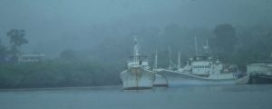
Fishing boats in the rain, Tradewinds anchorage, Suva
We anchored off the Royal Suva Yacht Club, which gives the visitor a good welcome, and charges $10 a week for use of all its facilities. The Sunday night barbeque is a popular party for all the cruisers. The other Suva anchorage is off the well-known Tradewinds Hotel, much prettier and more sheltered than the club, but further out of town. Still, the hotel lays on a free bus to Suva twice a day, the local bus is cheap anyway, and the nearby town of Lami provides excellent shopping for everyday needs. But Suva is at the windward, wet end of Viti Levu, and it never seemed to stop raining when we were there, which dampened our enthusiasm for this really very pleasant south seas city. So, after a couple of weeks listening to yachties on the radio saying how delightful it was in Tonga, we decided to get on our way again. It was the end of August 1982.
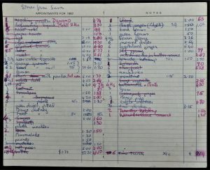
Norma's shopping and provisioning list
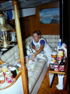
Norma sorting stores for passage to Tonga
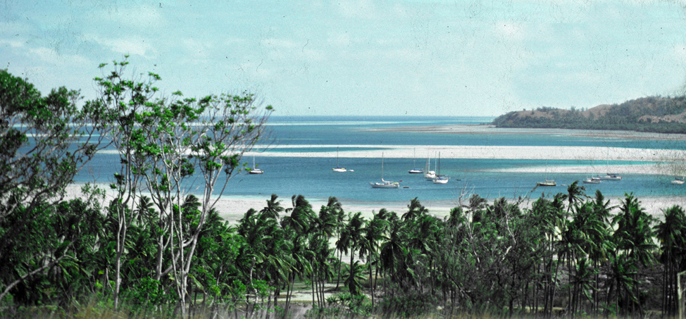
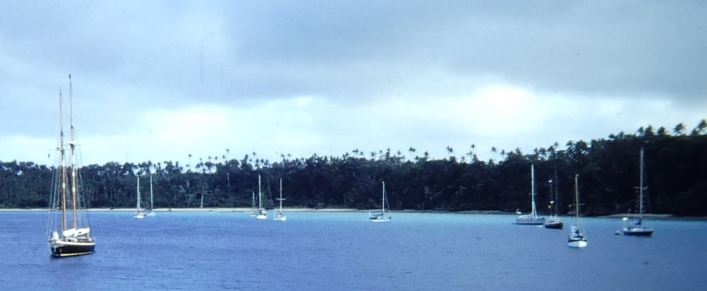
Vava'u group, Kingdom of Tonga
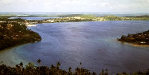
Port of Refuge; Naiafu wharf far left in sun
 We finally left Suva on a calm, overcast and humid day in early September 1982. The four-day passage started well, but the winds became adverse and the seas rough. The log records that during the first night out the conditions were “unutterably foul", and the next day’s forecast told us that we were being overtaken by an unforecast tropical depression moving south and bringing driving rain and heavy seas. We had already written off any plans for visiting any one of the Lau group of islands, as in those pre-GPS days they were to be avoided absolutely in conditions of poor visibility; yachts were being lost every year somewhere in the group. But as the depression moved through it did at least give us favourable, albeit strong, sou-westers for a fast run to the Vava’u group of islands in northern Tonga.
We spent the first day and night getting relaxed and settled in at quiet anchorage, and the following morning called in at the main wharf at the regional capital, Neiafu, on the shore of the Port of Refuge, the name given by Spanish explorer Francisco Mourelle in 1781.
 Much has been written about the beauty of the Vava’u group and the main town and harbour of Neiafu. Cook called Tonga “The Friendly Isles” after having been invited to a feast. Whatever their history, the Polynesian people of Tonga now are really among the most charming people you could ever hope to meet, with an approach which is quite different from the more “pushy” friendliness of the Melanesians of Fiji. We went through easy entry formalities with friendly officials, who assured us that yachts were welcome because “they spend money here”. In fact, up to a couple of years before we arrived, few yachts were visiting Vava'u because of absurd restrictions on movement within the group. This policy was changed abruptly after a survey confirmed how much the yacht visitors were spending, particularly at grass-roots level in the market and villages. Cruising people, we were told, were now assured of a good welcome and full freedom of movement.
 Among those who welcomed us at the wharf were local people who were offering hospitality through the provision of weekly “feasts” at assorted locations among the islands. We first met Metoto and John, to whose feast
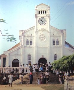
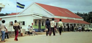
 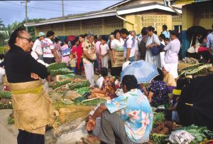 in a few days’ time we were invited, and Aisea, whose function would be a week later. Then, in beautiful weather we went out to anchor in the bay, did lots of washing and shopping, fixed up some minor problems in the boat and got a new battery. Neiafu in 1982 was a very South-Pacific-looking town, with a Burns Philp store, colourful open markets for provisions and local craft, and an abundance of churches. The major one of these was St Joseph’s Cathedral, standing prominently on a hillside overlooking the town. Overlooking the anchorage was the Paradise Hotel, welcoming to yachts for meals and the occasional film show.
 The next move was to sail out and around several small and brilliantly pretty coral-fringed islands and in to a well-protected bay at the south end of the main island of Pangai Motu. On its shore we would attend John (left) and Metoto’s feast in the evening. There were several yachts already in this popular anchorage, some crews of which we already knew and many others with whom we would become firm friends over the next several weeks in the archipelago. Ashore there was also a big turnout of local people, kids, horses, and a good craft market. At this, we bought an excellent basket, and a bag and a wall hanging of tapa cloth. A small group of young local girls danced for us.
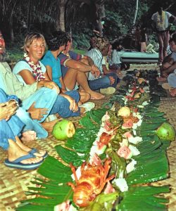 The feast, and others like it, cost $6 a head for more than you can eat: variations on lobster, pork, octopus, clams, taro, banana, pineapple, pawpaw, mostly cooked in the “umu” or covered dugout oven, and served on the ground on long trays woven from coconut fronds. These affairs were originally started for the half-dozen charter yachts, but the charter operation was pretty dormant when we were there and the feasts are now laid on for any and all of the cruising yachts.
The next day we walked ashore and crossed to the outer, ocean-front side of the island for Norma to search for shells. She became very skilled at this activity during our voyaging, seeking dead but beautiful shells in good condition and building up a superb collection. In the afternoon Metoto’s son Tevita came to the boat brought us a good supply of fresh vegetables. These were commonly offered in all the anchorages, but the prices were absurdly low, there was no pressure to buy (unlike Fiji) and no haggling.
Metoto Latavao and his wife Eleanor invited us to join then at their local church in the nearby village of Pangai. This was quite an experience. Invitations to a church service tend to be greeted by raised eyebrows among most yachties, but should be accepted in Tonga as one of the world’s great experiences. We found that the singing was spectacular (and very loud!), with every person in the congregation contributing to the harmony; the elders of the church are regularly moved to tears. They take religion seriously in Tonga, and a notice at the hotel wharf in Neiafu reminded visiting yachts that parties, and even activities such as swimming, are forbidden on Sundays.
 After the service we joined Metoto and his family at their house in Pangai. Sitting on the floor in a circle we enjoyed, after a kava ceremony, lamb flaps with cabbage in coconut milk, chicken, clams, taro and other root vegetables – a wonderful experience. A few weeks later we were invited again for another visit with them to their church and on for lunch with the family.
 After a few days we sailed gently up to another protected bay for the feast staged by Aisea (left). This was of much the same pattern, with a few changes in the menu and no
 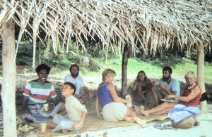 dancing. We bought more baskets. [Nearly 40 years later, these are still being used around the house!] After a good few days sitting in this bay, Aisea invited us and an American couple with who we had become good friends ashore for lunch on the beach – wrapped corned beef, taro, salad and Jim Beam – a long, lazy afternoon with intermittent showers, sheltered under a pandanus lean-to.
And so life went on in a similar fashion for the next several weeks. It is possible to arrange private feasts at a nominal (even lower) charge,  and a group of us did so on an uninhabited “day-stop” island. The group of villagers who laid it on came with us on the four yachts, bringing a suckling pig (live, in a sack) which ended up in the umu along with several other delicacies, including fish speared in the morning. Again, an unforgettable experience.
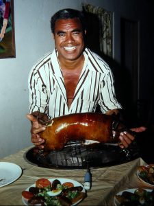 One day, walking ashore, we were met by a local landowner, Kelepi (right). He took us in his truck to see his plantations, some 64 acres, including the lucrative vanilla beans. He invited us and a British couple back to his house that evening for an immense spread, centred on an absolutely delicious spit-roast suckling pig, corned beef "omelettes", steak, chop suey (!), salad, sausages, fish . . . followed by a hairy ride back to the beach and the dinghy. Kelepi was very proud of his standing in the islands, and gave us several lectures on the value of goods and services. His favourite phrase was "'fink in terms of . . . ", and we still use it today.
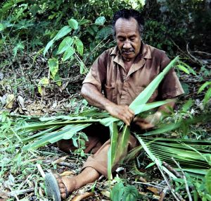 Another islander, Isaka, paddled over one afternoon and suggested we might like to see the process of vanilla pollination. That we did, along with a lesson on basket-weaving. At his large house, by village standards, we were loaded up with pineapples, pawpaws, cabbages, carrots, tomatoes, cassava, taro and vanilla beans - all from his "garden"! In meagre return we fixed his old Singer sewing machine and tendered a couple of presents for him and his family. Lovely people.
 We found that for us, cruising among the Vava’u islands approaches perfection. It is a close-packed group, of volcanic origin, so that most anchorages are virtually land-locked and the sailing is in brisk trade winds but without the usual accompanying swell. The turquoise water is clear and the reefs well-defined and easy to see. Fish are abundant and non-poisonous, but mostly pretty small. We thought that the coral was not “pretty” by tropical standards – a recent cyclone had battered much of the life out of much of it, and in addition we saw several crown of thorns starfish.
 The numerous protected anchorages are within half a day’s sail of each other, and offer shell-collecting possibilities which are unsurpassed (although Norma, among other serious collectors, wouldn’t tell other than trusted friends where the best shells were). We particularly remember one of the most intriguing anchorages in the whole Pacific. This is actually within the high ring of a volcano, Hunga, through which the sea (and a spot of dynamite) has blasted a narrow passage between steep cliffs. We shared the anchorage with another boat, whose American crew were among the scores of friends we made during our time in the Vava’u islands.
We spent two hugely enjoyable months in the Vava’u islands. But we had to get moving because the cyclone season was approaching, and route  decisions had to be made. The original plan had been to continue east from Tonga, adverse trade winds notwithstanding, and spend the cyclone season (around December/April) in French Polynesia. However, we were longer in the Vava’u group than anticipated, a long beat in the teeth of the trades was uninviting, and there were several interesting islands in the central Pacific we could visit if we chose a more direct route towards Hawaii and the Pacific North-West, our ultimate target at the time. And they would be outside the cyclone region by the time we got there.
Further, however far east we went in the Pacific or elsewhere in the world, we had decided finally to return to Australia westabout across the Pacific so that we could take in French Polynesia at our leisure at some time in the future. In retrospect, this was a good decision; six cyclones hit French Polynesia during the season of 1982/83, after decades free of these destructive storms. We feel our guiding star was very good to us on this occasion.
Therefore, in late October we left to sail not east but north, for Pago Pago, on Tutuila Island in American Samoa.
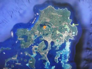
Pago Pago, American Samoa
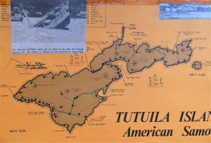
The weather in Tonga had been gorgeous, and we left Neiafu in a spanking “reinforced” sou-easterly trade driving us fast to the north-east towards American Samoa, but it soon clouded over and reverted to what we had come (resignedly) to accept as standard passage-making conditions: rough, overcast and wet. The waters around Samoa, we discovered, are notoriously turbulent, and several yachts entered Pago Pago Harbour in a sadly bedraggled state.
On Sunday October 31 we crossed the Date Line, so the next day, on our final approach to Tutuila Island we had Sunday October 31 all over again!
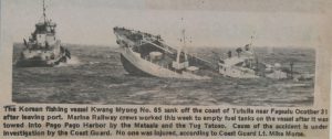 We had an unforgettable experience approaching the entrance to Pago Harbour. Following the leading marks through fringing coral reefs into the big bay, in what had become by that time a howling easterly (number three headsail and two reefs in the main), a Korean fishing vessel drifted across our bows, obviously in trouble with its engine apparently out of action. From a few hundred metres away we saw it grind on to the reef on our left, under Battery Point at the southern entrance to the harbour.
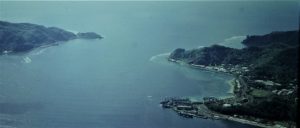
Entrance to Pago Harbour, seen from hilltop
 We watched helplessly as the ship’s boats were launched and flares lit, but it was all too late. Our call on the emergency Channel 16 VHF was unanswered, it being Sunday, but the reef is only a stone’s throw from the coast road at Battery Point and an onlooker ashore must have raised the alarm. A tug eventually went out and towed the stricken vessel back into the harbour, but she finally sank just across the bay from where by that time we were anchored. Finally, only the bow portion remained, sticking forlornly out of the water at 45 degrees. They then started pumping diesel out of the tanks, fortunately with very little escaping to the water.
Often windy and wet
The next day, with the strong easterly wind having reached gale force with squally rain we were unable to go ashore to clear Customs, but they came to us instead for provisional “entry|”. These persistent strong easterlies are typical of Pago Harbour, which faces east and some high hills that accelerate the gusts, and we – like most others anchored there – set out a second anchor.
We finally did get ashore for some re-provisioning, but were not very impressed. The prices seemed high, by South Pacific standards. Back to the boat, for the first of countless times, we struggled to climb back out of the dinghy as both this and Cera jumped about in the wind and choppy water.
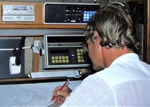
Shipmate NAVSAT - new toy!
The main reason for our calling in to American Samoa was that we had ordered one of the first compact and relatively inexpensive satellite navigation devices built for yachts, and thought that this would be a good base for ordering and taking delivery of the hardware. This was not the same system that we are now so familiar with, which uses a large number of geostationary satellites and called the Global Positioning System (GPS). What we were so anxious to take advantage of was the then existing US Navy Navigation Satellite System (NAVSAT), which was using a set of orbiting satellites. Positioning fixes were not constant, as is now the case with GPS, but provided fixes on nominally an hourly basis. In practice, as we and others found, the gap between fixes ranged from half an hour to six hours. Nevertheless, at the time, this seemed to us such a miraculous advance on celestial navigation we could hardly believe it. It took a long time – years – before we trusted it absolutely, and we took at least sun sights with the sextant for position confirmation in all the rest of our ocean voyaging.
But the whole business took a lot of time, and indeed we were there for over a month managing the necessary correspondence, transferring money, waiting – and waiting – for delivery, and then again for some missing parts.
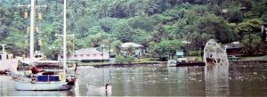
Pago waterfront
 We supposed that people get used to Pago, but we would have hated to spend the whole four months or so of the cyclone season in the harbour, as several yachts were aiming to do. The local culture is an uneasy mix of Polynesian and American, with the less attractive features of each tending to dominate the people’s approach to life. American Samoa is a US trust territory, and millions of dollars of American aid have fattened the bureaucracy and raised the expectations of the local people (for one day becoming a State of the USA) to an entirely unrealistic level.
The inevitable crunch would be uncomfortable, we thought, as the locals appeared to have forgotten how to subsist Pacific island style. We thought that the market at the harbour was poor, with much “fresh” produce imported from New Zealand or the States. Unlike Tonga it was impossible to buy local fresh meat, fish or eggs – all are imported frozen. Even coconut milk, of all things, comes in tins from Fiji! Big cars such as Lincoln Continentals and Chevrolet Camaros competed with customised utilities for space on the few miles of narrow roads. Because the multitudinous pigs which roam everywhere else in the south Pacific (and eat rotting fruit where it falls) seem to be regarded as un-American in Pago, fruit flies abound and make most local fruit inedible. Food containers are just dropped in the street. However, there is a splendid, cheap, stop-anywhere bus service, which we used to get to the big, modern store at Nu’uuli, near the airport. Liquor is cheap, being free of duty, so we stocked up for several months.
Fagasa Bay
Problems aside, Tutuila itself is a very beautiful, lush, high-peaked island. We spent much of the time during the waiting period seeing as much of the island and its hilly and heavily-wooded scenery as we could. We undertook some good and quite tough walks over the hills to the attractive bays on the northern shores, such as Fagasa Bay. There are some beautiful views from the hilltops around the harbour, including from the unused cable car terminal. (The cable car over the harbour was hit by an Orion plane in 1980 and was 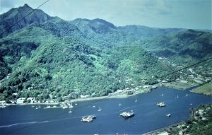 shut down.) We took a bus to the eastern wing of the island and then walked over to another very pretty bay and village of Masefau (population 800), where we spent time with the school principal. This all looked a lot more South Pacific, with simple fales in the villages and open meeting places. The bus was pretty basic and the driving awful; we have always said that the most dangerous experience in worldwide travelling is taking the local bus.
Closer to "home", recreation included attendance at a “cultural experience” at the western end of the bay, along with many other yachties. This was primarily an event for the crews of the visiting Korean fishing boats, and all had a good time.
 As the cruising village developed, Norma fixed a good few friends’ sails; a sailor in the anchorage was quite an attraction! There was a rudimentary shower in a wooden box on the small wharf we used to get ashore. We also took bus trips to the other side of the island and to its western extremity, through hilly and heavily wooded scenery.
Cruising the boat elsewhere around Tutuila is frowned upon, and the few anchorages are open roadsteads anyway; if we had known we were to be there so long we would have spent some part of the time in Apia, Western Samoa, which was very well spoken of and since visited by air.
So, after having been assured by testing the new satnav several times that we were indeed still at anchor in Pago Pago, we sailed away generally east for the unsurpassed peace and solitude of Suwarrow atoll, in the remote northern Cook Islands.
To the Northern Cook Islands, Suwarrow (Suvarov) Island
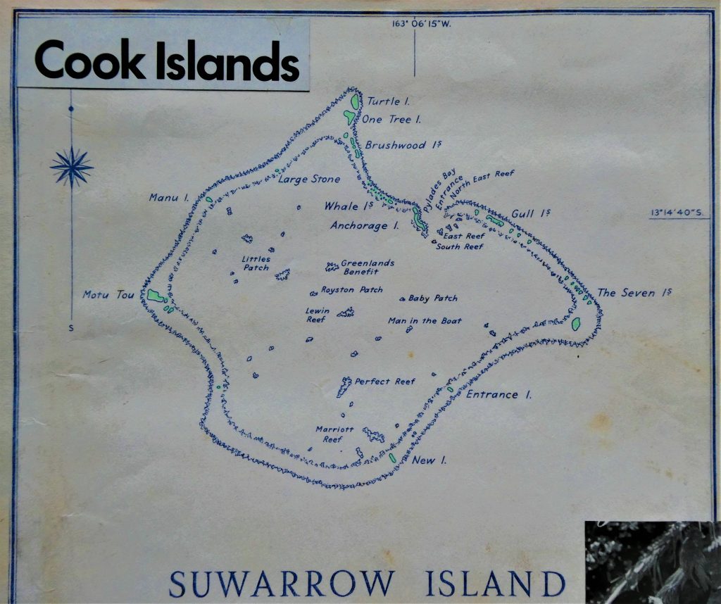 To sail into the lagoon at Suwarrow (previously known as Suvarov) atoll is the special dream of cruising sailors around the world. No other uninhabited island in the Pacific has the same combination of unspoilt solitude, beauty and (mostly) safe anchorage, merits which have been eloquently described by the last of the island’s hermits, Tom Neale, in his book “An Island to Oneself”.
So it was with extra anticipation that we left the noise and 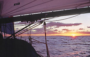 bustle of Pago Pago for what turned out to be a pleasant 450-mile close reach to this remote atoll, first sighting it in the pale light of the tropical dawn.
Suwarrow is a large classic atoll, about five miles across. It was once the tip of a 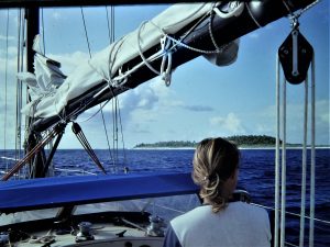 volcano, a mountain rising from the bottom of the ocean. What is left of the volcano's rim is a ring of coral reef, with a scattering of small islands on the perimeter like beads on a necklace.
The one pass through the coral reef is on the north-east side of the atoll adjacent to Anchorage Island. We approached with great caution, winding our way around the eastern end if this little island and coming to anchor inside the atoll.
Suwarrow was inhabited by Polynesians during prehistory, but it was uninhabited when discovered by the Russian-American Company ship Suvorov, in 1814. Various efforts were made to commercialise the atoll through gathering mother-of-pearl, coconuts and guano, but these were abandoned after a damaging cyclone in 1914. Observers were based there in WW2, but again a cyclone washed away the facilities, leaving only a hut with a water tank and several chickens and cats (to control ships' rats).
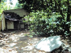 Kiwi Tom Neale lived alone on Suwarrow for a total of 16 years in three periods between 1952 and 1977. He described his experience in the first two of those periods in his book An Island to Oneself. During his absences others tried to settle and live there, but could not handle survival techniques or find enough food. Neale finally returned to the atoll in June 1967. He stayed there until 1977, when he was found ill with stomach cancer by a visiting yacht and taken to Rarotonga, where he died eight months later. He left a letter tacked to the wall of his hut: “I am obliged to leave here to go to Rarotonga for medical attention . . . I earnestly hope that any visitors will respect my property. The gate to the fowl yard will be tied open for the fowls to be able to fend for themselves. Any eggs they may lay, people are welcome to them . . . Also I would appreciate it if visitors left a note stating the duration of their stay here. Thank you!”. The note and visitors’ book (which we signed) were still there when we looked around. On a stone in the tiny settlement is carved: “1952-77 Tom Neale lived his dream on this island”.
 In 1978, the island was declared a National Park of the Cook Islands due to the abundant marine and bird wild life it supports. The island and surrounding water is Crown land. Caretakers have come and gone since Neale’s time, but there was nobody there when we arrived in 1983.
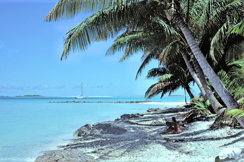
Some protection from the prevailing south-east trades can be found in the angle between this island and the reef to the north, on which breaks up the ocean swell with a thunderous roar and high white surf. A sharp weather eye is needed; nearly every year a few yachts get into trouble or are lost at this anchorage, where gales from north or south can blast through with destructive force. Arriving on December 17 we were well into the cyclone season, and as Suwarrow lies near the edge of the danger area we listened carefully to the detailed weather broadcasts from Hawaii at least twice a day.
Naturally, in view of this edginess, we had perfect weather for the first week of our stay! To add to the joy, we had the place absolutely to ourselves for this time, which is not so easy these days. According to the visitors’ book kept at Neale’s old shack we were the 74th vessel to call during 1982, and in the peak season of May-September there were up to eight or nine yachts in the anchorage at any one time.
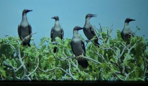
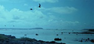
 Thus, in our solitude we happily played Robinson Crusoe. We took several trips out to the reefs and their islets, watching the countless varieties of birds, including frigate birds, tropic birds, white terns and boobies. We did some snorkelling, but the reefs were pretty battered and there were rather too many black-tipped reef sharks, about a metre long.
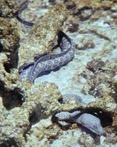 On one occasion Norma was out on the reef by herself when she nearly trod on one while stepping out of the dinghy at the reef edge; one as frightened as the other, she and the shark leapt for safety, with the shark in its terror nearly joining Norma in the dinghy! Norma rowed as fast as she could back to the boat but had trouble climbing up the boarding ladder because her knees were shaking too much! The large number of black-tipped reef sharks do prevent some of these activities from being completely free of care, and although the creatures are supposedly harmless they are very curious, territorial, and swim in exceedingly shallow water.
Norma as usual fished with some success from the boat, catching good fish that looked like snapper.
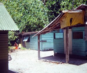
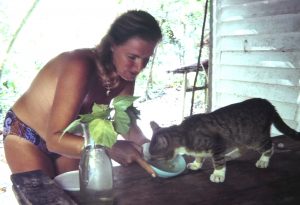 Ashore, Neale’s little shack and outhouses were still standing, with visiting yachties doing their bit to keep clear the paths and gardens. Though not the originals, a cat and several chickens roam free; shy at first, they all soon learnt to meet Norma at the beach as she came ashore each day to feed them, and trotted with her in convoy to the deserted settlement among the palm trees. The cat was shy to start with but finally emerged and soon became Norma’s friend, and, as such, regularly fed as well. We thought the cat would frighten the chickens, but the opposite was the case; the cat was very much ruled by the cockerel!
The weather remained gorgeous up to Christmas day, but the NOAA weather forecast told us there was a depression to our north and we could see banks of clouds up there. But we had a wonderfully happy 1982 Christmas dinner: pork pie, corn, peppers, roast potatoes and (luxury) heart of palm. This was followed by a chocolate mousse and accompanied by a bottle of Saltram’s Barossa Cab Sav. The whole occasion was a bit surreal; here we were, alone almost literally in the middle of nowhere, anchored by an uninhabited island in the South Pacific.
Our idyll was almost immediately changed by the arrival of another yacht, a sloop from New Zealand skippered by Greg. Greg was not one of the world’s best navigators, had been looking for the islands for days and finally approached from the east. Then the next day we were joined by Americans Geoff and Lily in a trimaran. They came right over and introduced themselves, asking whether we would mind if they spent most of the time without any clothes. We told them, no; in fact, we had put on clothes when we saw them coming over! We got on well with them; Geoff had made good money as a vet to the stars in Hollywood. He also had only one leg, which is why they sailed a trimaran; he reckoned its relative stability would help to keep him aboard.
 Greg’s crewman Leonard was something of a weirdo and jumped ship; he had decided to jump ship and live on the island. He had absolutely no notion of what that would entail,let alone how to gather and prepare enough food. Garry asked Geoff and us how to talk him out of it. We advised him to tell Leonard that living here was illegal, and when he would inevitably be found out, the Cook Islands administration were likely to ban all yachts from visiting the place. That seemed to work, and he returned aboard.
The weather, as forecast, was cloudy and wet for a couple of days, but on December 31 we weighed anchor and sailed out into a good trade wind and choppy blue seas. Late on the fourth day we made landfall at another island, in the most far-flung of the Northern Cook Islands, Penrhyn. We were to stay there rather longer than we anticipated.
Northern Cook Islands, Penrhyn atoll
The “normal” south-east trade wind backed through north to west during the passage, with generally light airs and a few rain squalls, so we had to work quite hard to keep the boat moving in uncomfortable conditions.
We were thus very pleased to see the tops of the coconut palms appear over the horizon on the late afternoon of the fourth day at sea. We shot in with the tide through the narrow pass rather late in the day for safe “eyeball” navigation through a multitude of coral heads, but the chart indicated that there would be a line of beacons leading us to the anchorage off the village of Omoka. Beacons there were, yes; but the last one before the anchorage had been painted the wrong colour, so we went the wrong side of it and thump – at low speed, fortunately, we had hit a coral head for the first time ever. This was the subject of great interest and hilarity among the local people who had gathered along the shoreline to watch!

Anchorage: islanders repainting beacon on right!
A later check of the keel showed superficial damage only, and we were soon safely anchored. Within minutes we were boarded by a pair of smiling young officials, Joe (Customs and Immigration), and Andrew (Agriculture) who was busting to get off fishing rather than spend much time with us. Andrew returned the next day with Ben (Health). Over the next few weeks we became good friends with all of them and their families.
I dealt with them while Norma dealt in vocal manner with the hordes of children who were clambering on to the boat fore and aft. (The offending beacon was changed to the correct colour two days later; “we thought it might be wrong” a villager told me.)
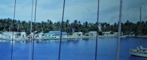
Omoka waterfront from up in the mast
Penrhyn was a curious place in many ways, the home of a very remote group of people who nevertheless felt associated with New Zealand and with a very sharp idea of the value of money – the only atoll we knew (then) which charged a fee to anchor in the lagoon. It was a truly sleepy place when we were there. The islanders live on fish, coconuts and what could be shipped in. Many islanders dreamed of a trip to New Zealand, where they can work or go on the dole (they have citizenship rights there) and send the money back home. Several of the children here were living with their grandparents while this goes on. But we found everyone very friendly, and we have fond memories of our stay there.
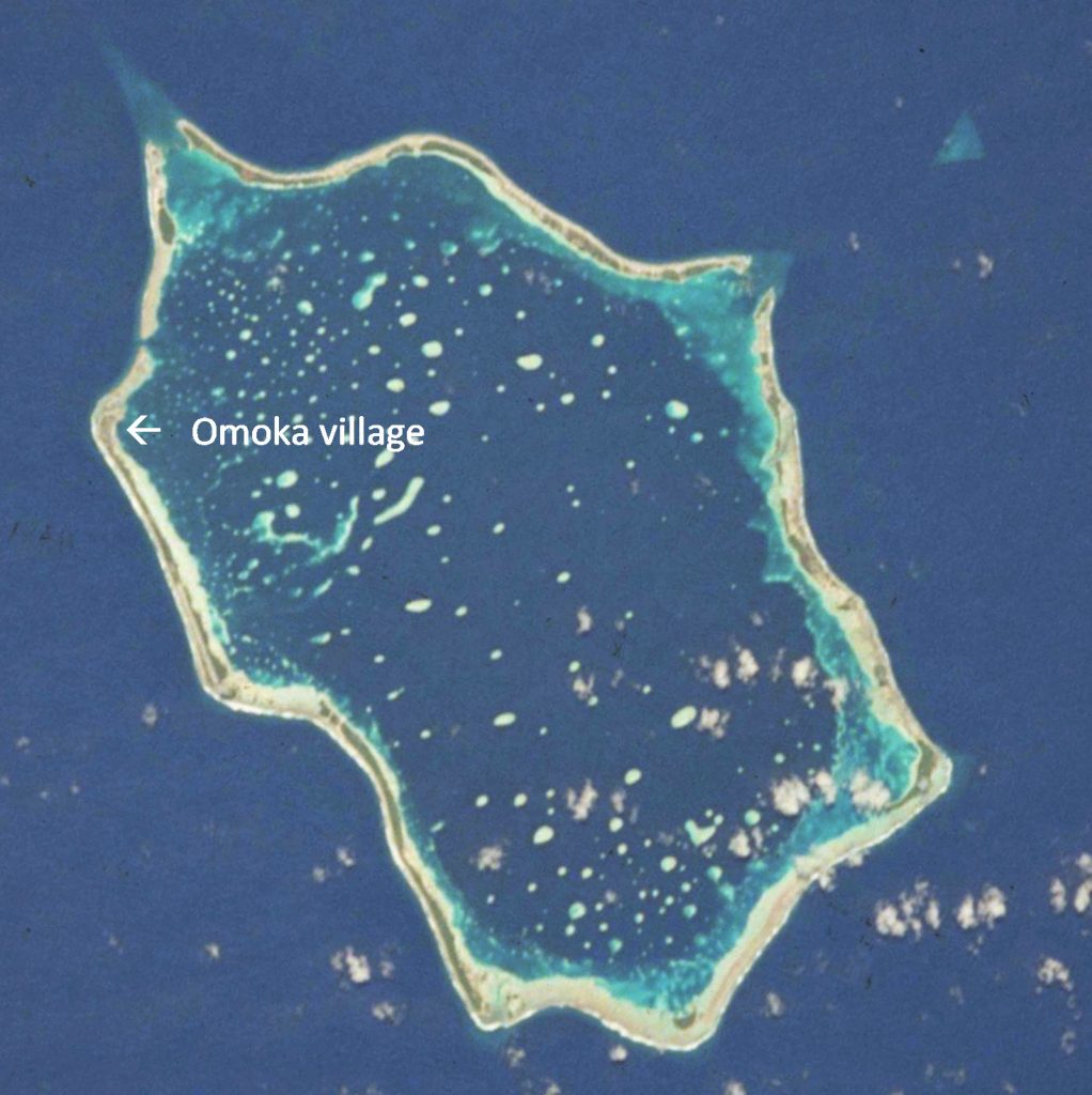
The pass we took to enter the lagoon is the notch just north of Omoka. The pass we took out is wider but shallower, on the north-east side of the atoll. The white spots are coral heads.
The atoll is named after the “Lady Penrhyn”, which sailed past on her way up to the China Sea after carrying convicts to Port Jackson as one of the “First Fleet”. We liked the older name, Tongareva, but can hardly cavil at the Sydney connection in its newer one! The islanders make a living from copra, tuna fishing and, more famously, from pearl diving. Penrhyn pearl comes in the form of large flat shells – “mother of pearl” – as well as in the form of beads. These natural pearls may be white, grey, pink or black and grow within shellfish which look more like little clams than oysters. We had been warned by a gem expert in Tonga not to expect bargains in Penrhyn pearls, and this was good advice; we were given a few pretty but misshapen pearls, but for good examples the Australian and American wholesale buyers were paying $100 a carat, way out of our range!
Pearl shells are gathered by free diving, and the divers are rightly famed for their prowess. Because of the need for adults to swim like fish, the kids spend all their free time in the water, which is surprisingly unusual in the Pacific. Incessantly running, jumping and diving from the village wharf, the children did at times become a pest swimming around and climbing on to the yachts, until some cross words, emphasised by their elders ashore, restored amicable relations all round. [Note: since we were there, the pearl industry has suffered badly, and is no longer of such significance in Penrhyn.]
Sadly, we found that by decree of the island council we could not move our yachts to any other anchorage in the large lagoon, although it appeared to be possible to move right across the lagoon to the smaller village of Ta Tautua. There are hundreds of coral heads throughout the vast lagoon, but in favourable light they are easy to see through the clear water. The main reason appeared to be pillaging of the pearl beds by a couple of unscrupulous yachts with scuba gear a year or so before. Although disappointed, we could only sympathise with the islanders’ urge to protect their income. So, again, we walked, fished (exceptionally easy – fish off the boat to order within 10-20 minutes!) and took the dinghy to nearby motus for more of the same.
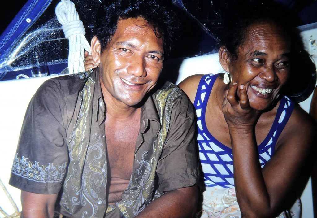
Andrew and his wife

Joe and family
We became good friends with several other islanders, but particularly with the families of the two officials who had signed us in when we arrived, Joe and Andrew. We went fishing outside the entrance passage with Andrew and his boys, in their outrigger canoes. This was quite an experience, as we observed one of their traditional ways. The fisherman snorkel dives while holding the coconut-baited hook and trace in one hand, trailing a fishing line from the boat. In his mouth he has chewed-up coconut or raw bait fish, which he gradually spits out when he sees a promising shoal. As the fish then investigate he hand-feeds his chosen prey, which is then quickly hauled into the boat to beat the ever-present sharks! These sharks – especially outside the lagoon, but inside too – follow all this with great interest and take great lumps out of anything you catch unless you are very quick getting it in.
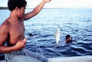 We asked more about sharks, because the whole point of this exercise is to prevent sharks taking fish off the hooks before they could be taken in. We were told that the black-tips were safe, but the bigger white-tips were dangerous. During our outing one of the boys did decide to jump back into the canoe with some urgency!
The sharks somewhat dampened my new found interest in spear-fishing, as although you can snorkel for quite a long time without seeing a shark, as soon as you take a gun, one appears out of the shadows and starts circling, looking for a meal. The vast majority were black tipped reef sharks of the kind we had seen in Suwarrow, which the locals had assured us were harmless. However, there were also white-tipped black sharks in the lagoon, which they treat very warily.
We much enjoyed the company of the friendly islanders, past whose homes it was difficult to walk without being invited in for a visit. We were taken round the 3-4 bed hospital by the doctor, a Cook islander on secondment for a nominal 18 months. He gave us some fish and took us to see the fish freezing works that had been run by an American for the last two years – and so it went, one visit went on to another.
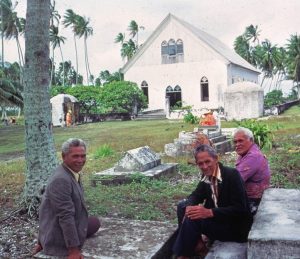
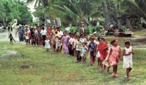 We had arrived in the first week in January, which is the height of the “festive season”. The influence of the missionaries is still very strong, and the festivities are all centred on the vigorous singing of “hymns”, Polynesian songs using Biblical tests for words. The Cook islanders are famous for this, and we were lucky to be there the Monday after the first weekend of the year, the biggest singing day of all, signifying the end of the Christmas/New Year holiday. The village splits into two teams, “red” and “blue” – meaning, we were told, “Communists and Americans”! From six to midnight these groups vied with each other, singing their hearts out non-stop in the inimitable close harmony of the Cook Islands, alternating from one team to another. We went regularly to church, and were also invited to the big annual “uapo” or religious songfest, at which the groups alternate with songs of ear-splitting intensity and often great beauty in true island style. We counted ourselves especially lucky to have been there at this time.
There is another, smaller village on a motu the other side of the lagoon, and under normal conditions we would have been able to stay there for a while. However, the developing west wind would have made the anchorage very uncomfortable, and we never made the trip over.
Any mail only went out on the occasional plane or boat to Rarotonga, normally at about two-monthly intervals. There is an airstrip along the southern part of the island, surfaced by crushed coral but long, which was put down by the US in WW2. About 1,000 GIs were based on the island between 1942 and 1946. The runway was to support a supply route between Australia and Hawaii. The remains of a crash-landed Liberator are still to be found near the airstrip and around the village, with bits and pieces to be seen in house walls and used by the locals to make small utensils. A story on the web is that the plane, GoGettin’ Gal, had been on a bombing mission and received extensive damage from anti-aircraft fire, and that he had landed the plane with the crew on board.
One of the older locals with whom we spent much time, a retired policeman, told us that on the plane’s final approach the generator for the runway landing lights had failed and blacked out the airstrip just as it was past the point of no return. Our policeman friend rapidly organised a line-up of villagers with flaming torches, but most of these burnt out too early and the aircraft overshot to port, landing among the coconut trees. The pilot sustained minor injury to his ankle, but all the crew survived. The base Commanding Officer was court marshalled for letting the lights go out.
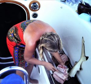
Norma filleting a shark caught from the boat
After a week in the Omoka anchorage the weather changed very much for the worse as the wind settled in in firmly from the west, often along with heavy showers. Under “normal” conditions westerlies are rare in this part of the world. The Admiralty Sailing Directions and the US “Pilot Charts”, which summarise statistics from decades of observations, agreed that at that time of the year westerlies were virtually unknown – fewer than 2% of observations. But the islanders were not surprised at the conditions, and said they could continue for months! We were protected from the westerlies by the low-lying land and high coconut palms, but were becoming tired of wild, wet and windy nights. It was becoming clear that we should get going again to the north, and we went ashore to make a tour round all the friends we had made in the village.
The west wind had effectively shut off the narrow but deep entrance to the lagoon on the north-west side of the atoll, through which we had entered. We were finally forced to grope out through a little-used pass out to deep sea on the east side of the atoll, which is normally blocked by breaking water piled up by the “prevailing” easterly trades. The pass is unmarked and riddled with coral heads. It therefore gave us some anxious moments as we conned our way out through a steep swell, with me shouting directions to Norma while I was perched high in the spreaders and clutching the mast as the yacht rolled from side to side, up and down.
Christmas Island (Kirimati), Line Islands of Kiribati
Our course from Penrhyn would be to the north, towards Christmas Island, where we looked forward to exploring its considerable land mass. We anticipated that Cera would lie securely in what the chart and sailing directions showed as a sheltered inner anchorage, to be reached through a shallow but passable channel.
Strong, squally westerlies helped us to a 6-knot average for the first few days, as we sailed into the “inter-tropical convergence zone”, ITCZ, called the “Doldrums” in older times. This is where the climatic conditions of the northern and southern hemispheres meet. Particularly in the Atlantic, the zone features variable but largely hot, calm conditions much hated by the sailing ships. For us on this occasion the ITCZ represented a 300-mile belt of foul weather, of incredibly forbidding aspect: the skies were full, layer upon layer, of cumulus of every conceivable shape and shade, and shifting and quite strong winds punctuated by black rain squalls with gusts of great ferocity.
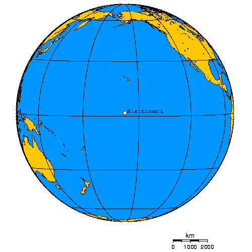
These latter were more common at night, when they were impossible to see coming – the first we would know of them would be the sound of driving rain on deck as the boat heeled and then drove off in a torrent of water in the wrong direction. Leaping into the cockpit to take control over the wind vane self-steering system we would have to run off before each short-lived gale as we fought to reduce sail in the carbon-black, wet night. And that’s how we crossed the equator, just before midnight as January became February, 1982. We were very close to the geographical centre of the vast Pacific ocean, a lonely and sometimes forbidding place to be.
At the longitude where we crossed, there is no Doldrum belt in the sense of a band of windless weather – the Doldrum calms are more prevalent at the eastern and western zones of the central Pacific, rather than in the middle, where we were. Celestial navigation became next to impossible, and we blessed our new navsat as it faultlessly helped us plot a more-or-less straight 700-mile path through these troubled waters, giving instant feedback on the fast, west-running equatorial current.
During this hard-working passage, Norma suffered rather from sea sickness, and for one bad, rough night I had a recurrence of the extremely painful renal colic which had hit me in New Zealand. “I’ve got some bad news”, I said to Norma when the first spasm hit and rendered me essentially immobile. It was with great relief when we finally closed on Christmas Island, hungering for the safe haven we expected to find.
We knew that good friends of ours had been there a couple of months before, and had found good protection adjoining the main settlement of London, in the deep anchorage that was shown in our chart and could be reached from the outer lagoon through a two-metre channel. This would be just passable for our draft, we hoped
The conditions we had faced latterly in Penrhyn and during this passage were being spawned by one of nature’s most malignant children, El Nino. The world would later learn that the 1982-83 El Nino event caused countless millions of dollars-worth of damage. The trade winds stopped or came from the “wrong” direction, ocean currents reversed as warm water swilled from the western Pacific to the east, tropical storms raked French Polynesia and violent seas destroyed parts of the North American west coast. And although we knew none of all this at the time, we were soon to experience at first hand just how much El Nino could change a tiny atoll in the central Pacific, and thus give us perhaps the worst few days of our voyage that far.
 Six days and 660 miles out of Penrhyn, we approached the island with even more than our usual caution. The Pacific Ocean chart has “low and dangerous” printed under its name. The Admiralty chart of the island itself warns of two-knot west-going currents, suggests that the Bay of Wrecks on its eastern shore is “very dangerous”, and records the position of several sunken vessels scattered round the reef. And as further signal reminders to take care, two recently-wrecked yachts lay high, dry and clearly visible on our approach to the fringing reef. One was a ketch we had visited in New Zealand, and the other was a supersonic-looking racing catamaran. On final approach the towering clouds cleared as we closed the coral on the west side of the island, and the wide pass through the reef - immediately south of the main settlement of London - was made only slightly awkward by a steep swell from the west.
Christmas (Kirimati, or "Kirimas") Island is one of the Line Island group just north of the equator and now part of the Republic of Kiribati. It was strategically important to the US and Allied forces during WW2, and the Americans were keen to hold on to it, but after years of squabbling all the Line Islands (Christmas, Washington and Fanning) became definitely part of the nation of Kiribati (pronounced Kiribas, previously the Gilberts).
Technically an atoll, Christmas Island is the largest island of purely coral formation in the world, partially enclosing in its northern part a large but mostly very shallow lagoon (blueish in the above aerial photo). Just inside the lagoon we handed sails and made ready to anchor before venturing further and searching for the channel into the protected anchorage within the lagoon protected by the small isthmus where London lies. We could see none of the channel markers shown on the detailed Admiralty chart, but there was nothing strange or unusual about that; few islanders in remote Pacific atolls bother to maintain markers set by their colonial forebears. To our dismay, we found the waters of the lagoon to be as opaque as milk; there could be no navigating through coral by eye. So we were relieved to see a little inflatable dinghy skimming out towards us. “Great, we exclaimed; “someone’s coming to show us the way in”.
The little boat zoomed alongside. “How much do you draw?” yelled its European driver. “Two metres”, we replied. “Sorry, there’s no way you can get through the channel to London. It’s been silted up by these westerlies; a whole sand island beside it has just disappeared!”
Norma and I exchanged miserable glances. Oh, no. We were tired, and now frustrated. Would we have to go straight back to sea?
“I can show you a place to anchor further in, just at the end of the channel, if you like?” “Great. Come aboard and guide us. Thanks a lot”. This alternative would mean we were still a long way from shore, but far closer than we were now, and maybe out of the worst of the swell. In we groped and on the way our guide showed us where the channel had been, as a Gilbertese canoe glided out.
Our guide introduced himself as Rieb Petersen, from Holland. He had been skipper of the wrecked catamaran, Stratosphere. With owner and crew aboard, the cat had lost both centreboards and rudders on passage from Panama; out of food and water, they had finally been driven over the reef and ashore on to the island. Rieb had stayed with the boat, with the intention that he should repair and, if possible, refloat her.
The depth sounder was looking gloomy, but did the water look a shade deeper ahead? Abrupt stop. Aground. Oh no. At near low tide in the middle of the afternoon we were in no real danger, but the swell was bumping us up and down on the hard coral bottom, rattling the rigging. Not for the first time we were glad we had an exceptionally strong vessel, designed by a naval architect who is also a professor of engineering. Rieb took our anchor out in his inflatable, and we winched the chain taut in an attempt to pull us free; but to no avail. There was more we would have to do, as we could not allow this pounding on the bottom to continue. “Thanks a lot for your help, Rieb. But we would really prefer to sort this lot out by ourselves now”.
“OK. But I’m sorry I got you into this. Is there anything I can do or get for you ashore”? “A loaf of bread?” we asked. It had not been a passage which was conducive to bread-baking. “I’ll see what I can do, and I’ll be back later. Hope you get off OK”.
Just as Rieb was leaving, a launch pulled alongside, disgorging two officials, Customs and Police, complete with pads and forms. Our hands were full enough already, but just as I was considering how to ask them politely to get lost, Cera was lifted by a swell and smashed down on the bottom with a tooth-jarring wallop. White eyes in black faces widened. “Is it safe?”
“No, it isn’t”, I replied, “We’re aground. We have to get off. We may not stay at all. Can we come and see you tomorrow, if we stay?” In relieved agreement, the officials left us back to our own devices.
And so to the next step, rowing out a larger supplementary Danforth anchor and taking its line to the masthead via a snatch block on the spinnaker halyard. Taking the line to one of our big headsail winches we were able to heel our stiff sloop over and drag her sideways off the shoal into marginally deeper water. At last, at 1700, we were lying to anchor, in a rather exposed position we thought, but peaceful for the time being and good enough for the night. After a couple of rums and one of Norma’s last remaining bottles of meat for dinner, and although Rieb hadn’t brought our bread, we gratefully turned in.
 The next day dawned wet, with a stiff breeze from the NNE causing a sloppy sea in the expanse of the lagoon, which is wide open to ocean swells entering from the west. It was time to be off and away out of it. But as we were considering tactics, out from the tiny settlement of London zoomed another runabout, this time carrying a couple of Australian soldiers, members of a detachment assisting under the Colombo Plan.
They told us they were on the island as part of the Plan, aimed at helping the islanders clear up and salvage the incredible mass of junk, ranging from warehouses through cranes and bulldozers to jeeps. This was left by the Americans and British, who had conducted dozens of hydrogen bomb tests in the vicinity during the 1950s and ‘60s. When the military pulled out they just dumped all their stuff – storage sheds, earth-moving equipment, trucks, generators, cranes – where it lay, leaving it to rust into the junk it now was.
The capital, Tarawa, which is some 2000 miles away to the west, was planning to clean up the mess, sell the scrap and develop the island. But the works were slow-moving. Even nature was giving up; a recognised bird sanctuary, for years Christmas Island had been a noted nesting place for terns, millions of them – but over the previous year they had nearly all gone, why and to where nobody knew. (Later, it was concluded that this vicious 1982-83 El Nino season had something to do with it, and the birds did return.)
The two Australians knew Rieb, of course. The previous day he had told them I was a doctor. And thus they came to the bad news. He had been injured the previous night. Could I come in and see him? There was no doctor on the island. So, aborting plans to set sail and leave, we again launched the dinghy and took the long ride to the settlement.
 Rieb was badly knocked about, with multiple deep abrasions and a possible facial fracture. Our request that he find us some bread had been hard to fulfil, as the island has no baker, just a little store with limited provisions. However, he had managed to wheedle a loaf out of the back door of the cement-block fishermen’s lodgings, and was rushing back to the waterfront on his motorbike so that he could bring us our bread before dark. Which is when, and why, he skidded and crashed heavily on the crushed coral of the road surface.
Elsewhere in the Pacific the Gilbertese people are recognised as friendly, smart and easy-going. But the Gilbertese residents of Christmas Island had a poorer reputation - some were saying as a consequence of the bomb tests. This was supported by the fact that immediately after Rieb’s accident the word got round that he was dead, and some villagers broke into the storehouse full of the wrecked yacht’s gear and stole much of it.
 Despite the attentions of the island nurse his numerous abrasions were already beginning to fester in the damp equatorial heat; so I advised the island administrator that he should be flown out for X-rays and hospital treatment as soon as possible. He had no money to pay for this, of course, but it looked like the Army would quietly arrange some sort of transport out for him.
We visited the little local shop, run by a young American couple, and were taken for a tour of the vast workshops and their masses of junk. It was nearly dark before we got back to the boat and, once again, were too late to leave. The wind had veered to the southwest, it was raining, and heavy black clouds to the west were the last we could see of the sky before we were enveloped by the black of what was to be a busy night.
We had set two anchors as a precaution, although our favourite Australian-made plough anchor was holding well, as usual. But the wind continued to veer and strengthen, and through the pitching and tossing we soon felt a jarring regular input, indicating that the anchor chain was snagged on a coral head that was, from the feel of it, very close to the boat in ten feet of water. Our rope line to the chain, set to relieve the snatching loads as the bow buried and reared, snapped and carried away. We dared not allow much more scope, for fear of coral heads behind us in the shallow water. We would have to try to unsnag ourselves.
So we fired up the yacht’s trusty Perkins diesel and motored round where we thought the coral head must be, deducing the direction of the tangle from the way we had swung. In the ink-black dark we could see nothing whatsoever beyond the boat; no shore lights, just pitch black, so we kept directional sense by way of the compass. To our vast relief, on the second try we unwound ourselves with a bang and the chain settled into its customary, soothing catenary.
Soon after the welcome dawn we recovered our now misshapen Danforth and undamaged plough, and with few regrets at leaving so soon, cleared the pass out of Christmas Island in the best conditions for days. It had been a terrible time at the island in many ways, but we had learnt a lot about the use of ground tackle in poor anchorages, made some friends and helped an injured sailor, and in 29 hours we would be in gorgeous Fanning Island where, it turned out, we were to enjoy three weeks of idyllic conditions.
Fanning Island
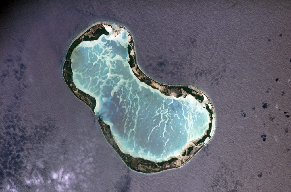 After another squally and troublesome passage Fanning Island appeared out of the gloom. We motored through the narrow but deep passage into the atoll about half way down its western side and anchored off the main settlement, just to its south. This had been another passage where we again blessed our new navsat, because visibility was very poor, the clouds obscured the sun, and fast ocean currents quietly tried to alter our course. And the atoll was, like others, hard to see and indeed to find at all without the magic of electronic navigation.
In the afternoon we were welcomed in by the Immigration and Police officer, and I treated an infected coral cut on his leg.
Fanning (or Tabuaeran) Island, like Christmas, is one of the Line Group of islands, a district of the Republic of Kiribati. The republic's capital, Tarawa, is in the Gilbert Islands some 2000 miles to the west. Fanning is a pretty, bean-shaped atoll about four miles across, with a deep, fast-flowing pass just to the north of the main settlement. It was in the recent past “owned” and operated solely as a copra plantation by a branch of Burns Philp, but before our visit it had just been bought back by Kiribati and was newly a port of entry for seagoing vessels.
Kiribati had taken back the lease from Burns Philp only recently, and its future was uncertain. The recent change in administration had brought some unease, as no-one (including the plantation manager, Alan Rush, who explained all this to us) was at all clear who was going to be paid, by whom, or when. Work on the plantation had stopped, and the BP supply ship, which normally brought “dry” stores (flour, sugar, tinned food etc) and transported the people was no longer expected to come. Alan was in the process of trying to set up a small fishing and fish-processing operation by way of some relief.
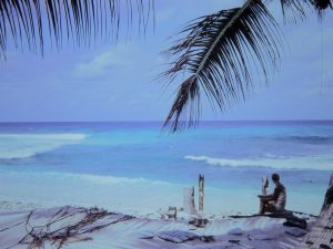
Norma relaxing on the outer side of the atoll
There are no permanent residents, the plantation labourers and their families being detached there from the Gilberts for pre-arranged periods. But the people seemed happy enough, as well they might in what has turned out to be one of the most pleasant inhabited islands we had visited. The fishing was easy (when lazy, I could shoot fish with the spear-gun from the deck of the boat!). Coconuts and other fruit and vegetables were plentiful in the unusually lush soil for an atoll – such as breadfruit, which makes good chips - pumpkin, taro and squash.
I was soon taken ashore taken to see a baby with a persistent, weeping boil on his leg. I suggested the use of antibiotics, but the island nurse told me that all she had was a small quantity of tetracycline syrup, which she was doling out in small doses – not the best possible action, but perfectly understandable.

Our friends in the protection of Cartwright Point; pass out to the ocean in the background
The main anchorage soon became very uncomfortable, with the renewed NE Trade blowing across the lagoon and competing with the tidal currents to create dreadfully choppy conditions. On the other side of the pass was a protected mini-lagoon behind Cartwright Point, in which we had seen two yachts lying. We tried to get in, but on the first attempt knocked into a couple of coral heads. Then Jim from Sybaris, one of the yachts, came over in his dinghy and guided us carefully in. This turned out to be one of the best anchorages we had experienced in the Pacific, and we relaxed properly for the first time since leaving Penrhyn.
The pass out to sea was adjacent to the anchorage. It was lined on the steep slope on each side with beautiful coral, and at the turn of the tide - the only safe time to swim and snorkel dive - their were myriad fish of all shapes and sizes. They included a giant ray, of at least four metres wing span, that glided quietly over my head one afternoon.
The crews of Sybaris and another yacht in the anchorage soon became firm friends, and we spent much time sharing experiences and meals with them. By this time we were living on a diet of bread, taro, coconuts, fish and breadfruit, and a question for discussion was for how long we could live of such sustenance alone? We had heard that the people living on Palmyra Island, to the north, were getting short of food and wanted more breadfruit; Sybaris foolishly volunteered to relieve them of their shortage, and soon became loaded up with breadfruit that rapidly became over-ripe in the tropical sun.
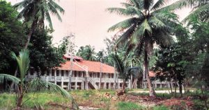 An oceanographic research team from the University of Hawaii had a 70-foot steel schooner on charter there, and the team was occupying an astonishing group of well-preserved, grand old colonial buildings which once housed the staff of the only relay station for the first cable to be laid across the Pacific. We walked across the atoll rim to see them. Now sadly neglected and overgrown, having been deserted when the cable was superseded some 20 years ago, the buildings – with an adjoining tennis court, swimming pool, messes, workshops and so on – are a mute reminder of the age when however remote the area, the European settlers would work to make it a little piece of home.
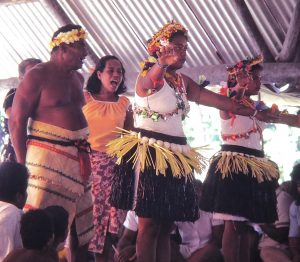
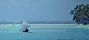 Along with a couple from the other yachts we were invited by the local people to a wedding party, where the gloomy-looking couple (tears are in order at such occasions) were entertained by island dancers, singing and speeches. We had to contribute by way of an address, with the police/immigration officer translating. (We had become friends with him, because as reported above I had treated his infected leg when he cleared us in, and had advised a relative on the rather hopeless treatment of the infant with probable osteomyelitis that did appear to be resolving a little). There was a splendid feast of spit-roast pig, various stews and island vegetables, all complete with their special favourite, tins of Camp Pie! A cake was cut by the weeping bride, and we danced while baby powder was sprinkled on our backs.
We thought that Fanning was a near-perfect atoll, but it was to be our last for some time, as we decided to skip the westerly detour to Palmyra on our way to Hawaii. After all that ocean, and living the simple life par excellence for so long, we were looking forward to a new contrast of the sort which makes such a joy of cruising: this time to the bright lights, big shops, restaurants and general bustle of the modern world which, at Fanning Island, seemed so far away.
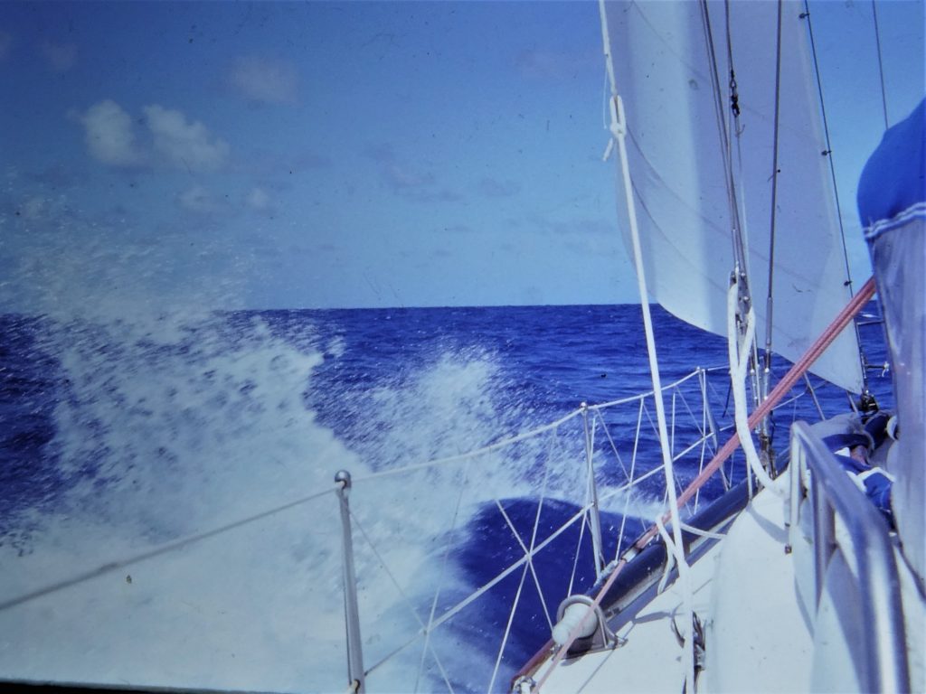
A splashy but finally splendid sail to Oahu, Hawaii
North to Hawaii
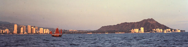 The tidal stream runs very strongly out of the pass at Fanning, and we shot through like a bullet into the rather alarming overfalls outside, where the trade wind was continuing to blow at the 18-20 knots from the NNE – exactly where we wanted to go. This had held for several days already, and although we soon settled down to a fast passage it became uncomfortably sloshy and wet. Resigned as we were to yet another windward passage, we were pleased that the trade did finally veer a little as we sailed along, giving us a grand trade-wind sail to windward, and Norma commented on the fifth day that at last "it all seems pretty peaceful". We reflected that it would have been paradise going the other way!
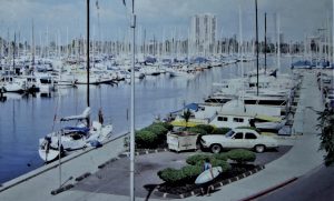 Our exciting landfall was after three weeks at sea, our longest passage thus car. We drifted into the waters off Waikiki, Honolulu, sharing a gorgeous sunset with scores of tourists out on traditional sailing craft and massive charter catamarans with itsy-bitsy sails. As we motored through the narrow channel into the yacht basin in Waikiki, friends from an earlier Pacific anchorage congratulated us on our ship-shape condition, thinking that we had just been for a sail round the bay!
It was Saturday evening, and Customs would not clear us in until Monday, so through Sunday we lay tied to Ala Wai marina’s loading dock, which is hard by the roadside in the shade of the Ilikai and Hilton hotels. We were kept busy chatting to local people and visitors interested in our voyage, and enjoyed the luxury of lunching on fresh ham, lettuce, and a glass of wine! We were not really supposed to leave the boat before formal clearance, but did sneak off to buy and enjoy some fresh provisions! Also, Norma was keeping small pots of herbs on the go, and she temporarily transplanted them into the urban gardens right by us on the roadside dock, being fearful that the agriculture officials would take them off her.
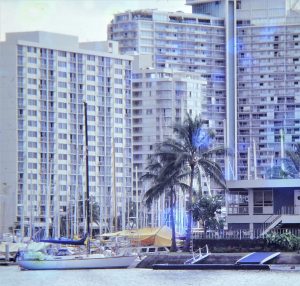
At the Hawaii Yacht Club
Finally cleared by Customs and Agriculture authorities on Monday, and as it happened they did not bother us at all. we were then free to move to the Hawaii Yacht Club, where all visiting yachts could tie up bow-to for a maximum of two weeks – nominally “free” berthing, but there was a $50 “facilities fee”! After that two weeks it was usually possible to arrange a transient berth in the State-run marina, but for four weeks only – after that, out!
We took three of those weeks, a further expense (as we bemoaned our newly devalued Australian dollar), but we were willing to pay for the great convenience of a splendid location between Waikiki and downtown Honolulu, a few minutes from the Ala Moana shopping centre, with water and electricity laid on and our bicycles parked on the floating dock alongside.
Iolani Palace
Old missionary building
So, we turned again from yachtsmen into tourists, enjoying the sights of the city, the shops, the restaurants, the concert hall and the movies. We hiked in the hills, and in a borrowed little Japanese "jeep" drove around and across the island. This belonged to our sailing friends John and Clydie Connolly, who were at the time living in Honolulu. They were to provide us even more valuable assistance in the future.
We visited the Bishop Museum, which is world famous for its Polynesian collection, as well as “old” Honolulu with the Iolani Palace, library, and preserved missionary settlement and church – all very fascinating and beautifully laid out. The zoo and aquarium are also attractively presented, with good collections of animals and fish. There is so much to see and do in Honolulu, we found it positively overwhelming. We had been there before, for a few days on a jet stopover, and this experience was good example of how much better one can come to know a place when pressures of time are eased.
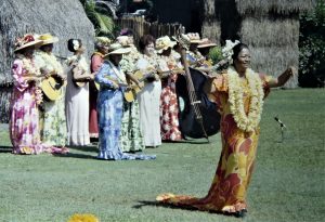
 Waikiki is of course the tourist centre, and is where most of the money is generated. It seemed to us that only a tiny proportion of tourists strayed from the beach, shops and restaurants there. It is as though the locals have invisibly walled off this section of the city, to the apparent satisfaction of all; we preferred that section of Honolulu outside the Waikiki enclave! Nevertheless, we did enjoy some touristy events, such as the famous "bed race" and a hula display.
We had re-read Mitchener’s “Hawaii” in Fanning, but even after this reminder, the oriental influence came as a surprise. Our favourite (the cheapest!) supermarket had a heavily Japanese influence, with an incredible array of oriental foodstuffs, what we thought was the most attractive department store is part of a Tokyo chain. We had some superb Chinese and Japanese meals.
After five weeks of all this activity we motored out of Ala Wai to Keehi Lagoon, where we slipped Cera (”hauled out”, as they say there) at the big Amfac yard to clean and antifoul the bottom and epoxy the dings on the keel. This is always an unpleasant business, of course, and was made doubly so by our close proximity to sandblasting operations on a huge steel schooner. So we wasted no time, and after only one night out we were back in the water – one of the quickest turnarounds the yard manager could remember!
Keehi Lagoon is the only place in Honolulu it is possible to anchor out, and was thus popular with cruising yachts out of time at Ala Wai and out of money for an expensive commercial berth elsewhere. We were happy to be among our many friends also waiting to make the passage to the Pacific Northwest, and to swing once more at anchor. Keehi Lagoon, originally dredged from sand flats to make a seaplane landing area, is actually quite a good anchorage, but a substantial way out of town. The most convenient way to get to the nearest supermarket was to take the “scenic” route by dinghy, across a corner of the main shipping harbour then up a smelly drainage canal which runs right by the shopping centre car park – very glamorous! We could take the folding bikes ashore there, and cycle into the city - sharing, rather inconveniently, bicycle lanes with the buses.
Keehi is also very close to the airport, so that we had to get used to jets booming overhead all day. We did a little more work on the boat and fitted the latest gadget, a solar panel to help keep the batteries up – our little wind generator had finally disintegrated, and we planned to build a decent wind/water generator once we got to the States.
After hours poring over Pilot Charts and Sailing Directions we concluded that the earliest practicable period for the passage to British Columbia was during the month of May, by which time the worst of the immense, ferocious north Pacific winter storms have usually retreated to the north and west. The weather is likely to be better in June, and most of the Americans and Canadians sailing home were leaving the trip till then, but we were keen to get as much time out of the short Canadian summer as we could. So, on 6 May 1983, the second time in succession we had braved the fates by starting a passage on a Friday, we sailed out of Keehi for the open sea again.
Apart from those angry north Pacific depressions (which we hoped would be up Alaska way by then) and their associated fronts, the main influence on this long passage is the north Pacific high pressure centre, which in May is usually about 1000 miles to the north-east of Hawaii. The recommended route is to sail north or even west of north from Hawaii, round the top of the high; a more direct route carries the risk of extensive calms, then headwinds latterly. But the high is not a fixed object, it varies in position and intensity, so we therefore planned to sail as direct a route as possible yet hoping still to stay to the north and west of the high, the position of which can be plotted daily by listening to the excellent shortwave (SSB) weather broadcasts from the San Francisco Coastguard radio station. This strategy worked very well for a long way. After bashing our way through the awful, steep seas of the Kawai Channel between Oahu and Molokai we settled (yet again!) hard on the wind, and by 32 degrees N we were able to lay the great circle course to Cape Flattery, with the high to the east and ridging north/south. It got colder and colder – and colder! Socks and several sweaters stayed on the whole time, and Norma complained that the juice in her bottles of meat was going solid and that the tomatoes and bananas had stopped ripening.
But morale was high, especially as Norma’s seasickness (a recently-acquired affliction) had responded dramatically well to “Transderm”, a piece of sticky tape containing the active ingredient which is affixed behind the ear, and we made good time for a couple of weeks. Then it all went wrong! The high just followed us up, sticking to the east of us and not allowing us to get round its top, so that with 700 miles still to go we were headed by a cold persistent nor-easter, forcing us to sail north when, at latitude 44 degrees N, we had every right to expect westerlies.
A constant overcast set in, with dank, cold drizzle turning sometimes to fog. But at last we were able to tack and lay Cape Flattery on port tack, and as we closed the coast the wind backed to the north-west, the skies gradually cleared, and our spirits rose again.
In the Strait of Juan de Fuca
We made Cape Flattery as the sun went down on 26 May, then motor sailed in a beautiful, calm night, lit by the full moon, through Juan de Fuca Straight. The Pilot books are very pessimistic about this seaway, what with its heavy shipping, fishing boats, fast tidal streams, overfalls, fog . . . so it was a bit of a relief to have such perfect conditions.
We quickly cleared Customs at a special wharf at the entrance to Victoria’s inner harbour, placed there to cope with the huge influx of US yachts competing in the annual Swiftshore classic, which was to start, as we soon found out, the very next day! So we shared the inner harbour with some 200 of the 400-plus entries, anchored out from the busy marina, which was not normally permissible. As we had coincidentally arrived at the culmination of the Victoria Harbour Festival, hardly had we set the anchor were we entertained in gorgeous weather by aerobatic displays, choirs and bands on the harbourside, and even a grand firework show! What a welcome this lovely city is giving us to Canada, we thought, and what a climax to our long haul across the Pacific Ocean from Sydney and the achievement of our first main target.
After the first several thousand miles of our voyaging our beloved Cera had proved problem-free, we remained happy and well, and not yet broke; so, as we lay in this lovely city, planning our cruise of the cool but protected waters of British Columbia, we began to draft plans which should see us in the Atlantic in 1984, and relished our good fortune in being able to do so.